|
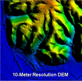
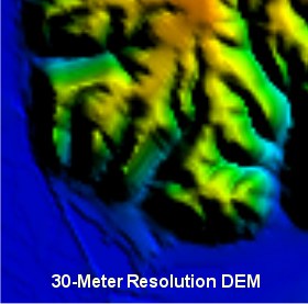
"Large
Scale" USGS 1:24,000 (24K) Digital Elevation Models (which
correspond to 7.5 minute topographic quadrangle maps that cover
about 6.3 x 8.7 miles) are available at 10 and 30 meter resolution.
30-meter data sets are available for the entire US. Parts of the
country have both 10 and 30 meter data (also known as 1/3-arc
second and 1-arc second data, respectively).
Even with JPEG
compression, the difference between the two resolutions is obvious
in the images above. They show blufflands along the Mississippi
River in western Wisconsin. These DEMs are displayed in Global
Mapper at about 25% zoom with hill shading turned on.
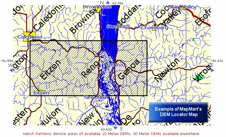
MapMart features
an excellent map-based
DEM locator showing where 10-meter DEMs are available. See
Links for more information and sources.
Back
|
