|
A
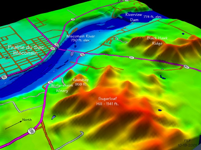
2D image without hill shading was prepared in Global Mapper
by displaying the DEM and DLG data for the Sauk City, WI quarter-quadrangle.
The image was next applied as an overlay in 3DEM. Finally,
text was applied in a photo editor to label geographic features.
Note how clearly the Digital Elevation Model captured the elevation
difference above and below the Riverview Dam.
Back
|