|
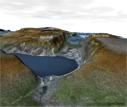
3D
Elevation Map of Wisconsin's Devil's Lake State Park - looking
east across the south end of the lake.
The
south arm of the moraine that helped create Devil's Lake appears
as the green elevation in the old river channel between the East
Bluff on the left and Devil's Nose on the right.
Back
|