|
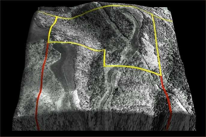
This image
shows the lay of a 100 acre tract of land within the yellow boundary.
The shape of the hill and the position of the old fields on the
ridge tops are clear in the 3D presentation. 3DEM was used
to drape the aerial photograph over the Digital Elevation Model.
The overlay was produced by scanning a paper photo of a more recent
vintage than was available on the TerraServer. The colored lines
were made on the 2D scanned image with a photo editor. The original
image is clearer, larger and can be rotated at will from within
3DEM.
Back
|