|
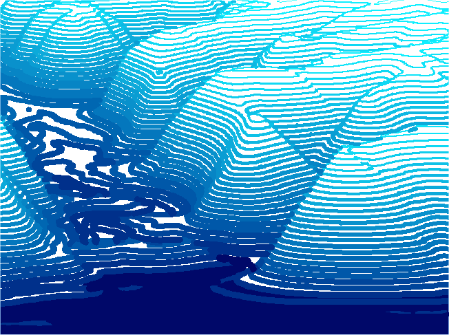
Art
is an integral part of cartography. With Surfer the two become
one. This image of Mississippi River bluffs was created by opening
a USGS 10-meter DEM of the Genoa, Wisconsin quadrangle as a wireframe
map in Surfer 8. Only the Z (height) plot lines are drawn with
a perspective projection selected in Surfer's property dialog.
See Forest Pal 's tips
for getting started with Surfer.
Back
|