|
Although
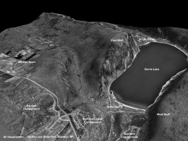
this image appears as if it might be an oblique 3D view from an
aircraft, it was generated by applying a flat Digital Orthophoto
(DOP) as an overlay on the preceding Digital Elevation
Model (DEM). The software that performed the conversion
is called 3DEM, described in the Toolbox. A DEM provides the elevation
frame that holds an overlay. Although this sample image is relatively
small, a full-sized picture with high resolution can provide a
virtual landscape with uncanny realism.
Back
|