|
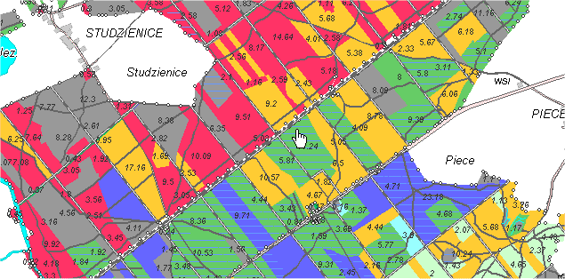
This
forest cover type map (used with permission of TatukGIS®)
illustrates a common technique in resource management projects
defining land uses with polygons stored as vector data.
If
you'd like, click the map and link with the
Tatuk Internet Map Server to experiment with the data. The
map might take a few moments to load. When ready, you can use
the "Identify" tool to click on a polygon to see stand
data like this sample:

| Parcel
data |
| ID |
1504008109 |
| FOREST
TYPE |
damp hardwood forest |
| AREA |
11.24 |
The
tool is a simple example of how GIS data can be associated with
a map object.
The
TatukGIS server offers additional samples combining image and
vector data and the opportunity to test object transparency (allowing
you to see through map layers).
Back
|