Enter your search terms
Web
www.forestpal.com
Submit search form
Map Toolbox
Map Data
Field Data
GPS
3D Maps
Links
Submissions
About ForestPal
TatukGIS Editor
Get fGIS now...click here
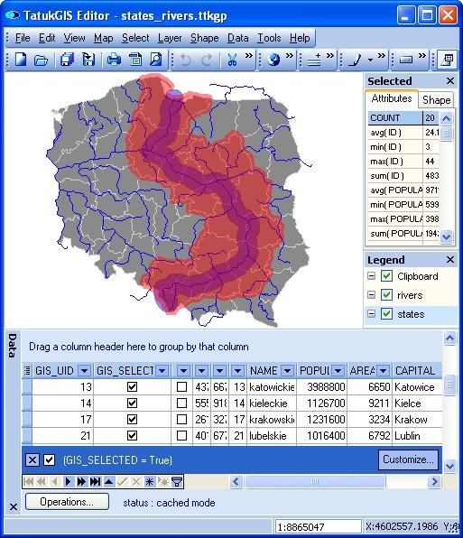
Use of a river buffer to perform a selection on a polygon layer. Attributes of the selected polygons are presented in the data table for further processing or editing.
back
About ForestPal
- Copyright © 2007-2011 ForestPal.com -