|
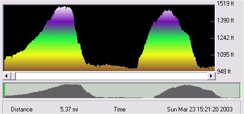
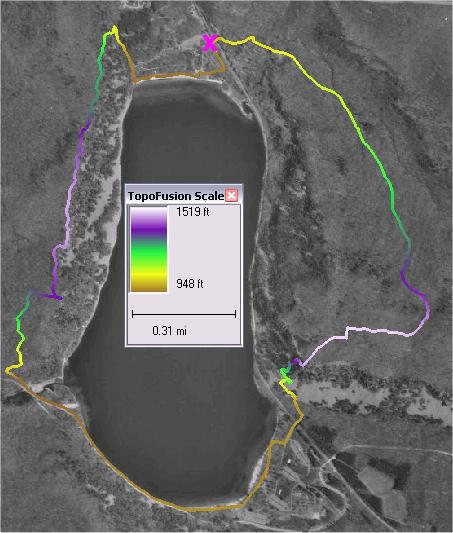
TopoFusion
created the elevation profile on the left from the GPS track shown
below. The track profile begins at the purple X and proceeds clockwise.
Rapid color changes along the track indicate steep climbs and
descents.
A
Garmin GPSMAP 76S with a built-in altimeter recorded the track
and elevations. A standard GPS unit relying solely on satellite
data might be less accurate.
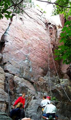
The
hike occurred at Devil's Lake State Park near Baraboo, Wisconsin.
The hard quartzite cliffs make the park a prime destination for
Midwest climbers.
Return
to ForestPal Toolbox
|